"Health region" refers to administrative areas defined by the provincial ministries of health. 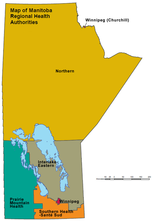 Ex. Winnipeg Regional Health Authority.
For complete Canadian coverage, each of the northern territories also represents a health region.
A four-digit numeric code is used to uniquely identify health regions. The first two digits represent the province, and the second two digits represent the health region.
This series of reference maps show the boundaries, names, and codes of health regions and peer groups in Canada, by province. Note the most recent information for these maps is 2018. Earlier reference maps are available for historical comparison.
Image source: Map of Manitoba's Regional Health Authorities
Health regions 2018 by peer group
In order to effectively compare health regions with similar socio-economic characteristics, health regions have been grouped into 'peer groups'.
Twenty–four variables were chosen to cover as many of the social and economic determinants of health as possible, using data collected at the health region level mostly from the Census of Canada. Concepts covered include:
Census geography covers a wide range of geographic areas—from provinces and territories down to blocks. These geographic areas have boundaries, names, and other information that make it possible to locate them on the ground and relate census data to them. Find statistics using a map as a gateway. Click the link below and follow the instructions.
Find information by region or area
Instructions:
1. Select a geographic region by clicking on the map. Use the scroll on the mouse or the +/- buttons to zoom in on regions.
2. Check Subject: Health. The list will expand and you can further refine the topic by selecting one of the key indicators, ex. Diseases and physical health conditions.
3. Check Content: Latest (this will exclude any older, archived content)
4. Check document type: tables (optional but recommended)
5. Select the desired table, ex. Arthritis, by age group
6. Tables can be further refined (depending on the variables)
More about using and customizing Statistics Canada data tables.
